
WEST ROSAMOND
NORTHWEST OF LANCASTER
2.59 ACRES – 230’ x 533’ approx.
KERN COUNTY
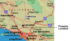
65 MIN. FROM LOS ANGELES
GREAT INVESTMENT!!
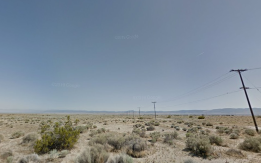
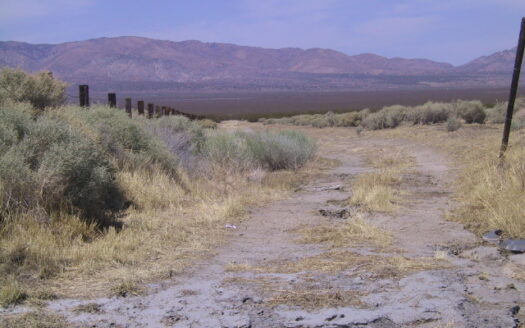
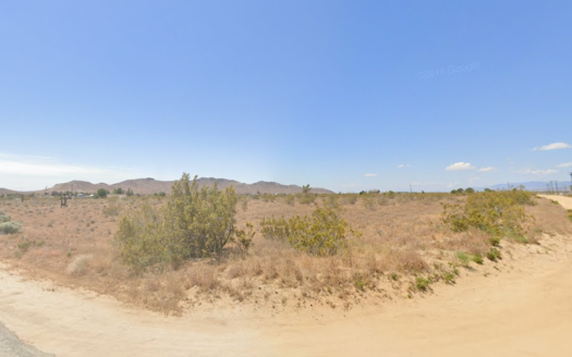
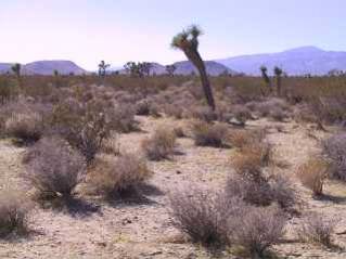
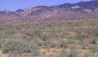
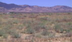
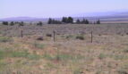
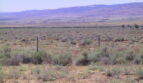
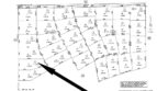
DESCRIP –2.59 acres just East of 200th Street and North of Gaskell Street. The property is 1 mile north of Los Angeles County in Kern County. The west side is the most desirable area; the prices have always been higher than other areas of the valley. There are homes in the area. Electricity is approximately 1 mile. The ranch that is near this property uses a generator for electricity. Water wells are used in the area with a depth of approximately 200 to 500 feet with a cost of about $15,000 to $20,000 to drill a well. There is legal access with good dirt roads to the property. The property is approximately 15 miles northwest of the city of Lancaster. The property is flat and 100% usable. Many people commute to Los Angeles from this area. There are great views of the surrounding buttes and countryside.
Lancaster is a bustling community with a growing number of industries, affordable housing employment, schools, recreational opportunities, and excellent smog-free weather over 300 days a year. Besides the preceding benefits, Los Angeles is a short one hour drive on Hwy 14. Bakersfield, San Bernardino and coastal communities are easy commutes too.
Rosamond is a bedroom community for Edwards Air Force Base. With an estimated population of 21,000 people, Rosamond is one of the fastest growing communities of the Antelope Valley. Home prices are less in Rosamond than they are in Palmdale and Lancaster, and the commute to Los Angeles is not that much farther.
Two of Rosamond’s main attractions – Willow Springs International Raceway and the Exotic Feline Breeding compound – bring lots of visitors each year. Another outstanding feature of town is Rosamond Sky Park, an upscale housing development that offers pilots an opportunity to park their airplanes in backyard hangers. The Park has runway access to Rosamond Airport.
TERMS – $7,995.00 – Monthly Payments $99.00 (including 7% interest)
LEGAL – APN # 254-321-13
Section 28, T9N, R16W
GPS Coordinates: 34°50’11.9″N 118°35’24.6″W
Zoning: Agricultural/Residential, horses ok
Size: 2.59 acres
Water: Water wells (200’ to 500’ in depth)
Electricity & phone: 1 mile from property
Roads: Excellent dirt w/legal access
Mineral Rights: Yes
Property Taxes: $50 per year
Other Agents